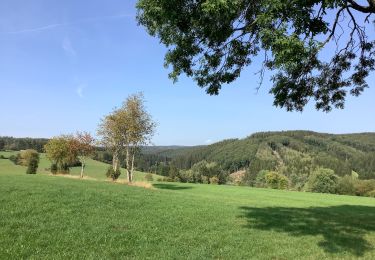
Trail Electric bike Saint Vith - ovelo---unterwegs-im-oberen-ourtal - Photo

ovelo---unterwegs-im-oberen-ourtal

 dejongm
dejongm

User

© OpenStreetMap contributors
Length
Length
44 km
Max alt
Max alt
644 m
Uphill gradient
Uphill gradient
776 m
Km-Effort
Km-Effort  
55 km
Min alt
Min alt
422 m
Downhill gradient
Downhill gradient
775 m
Boucle
Boucle
Yes
Creation date :
2023-06-23 08:23:41.604
Updated on :
2023-06-23 08:37:44.63

(0 Reviews)

Electric bike
Electric bike
0m
Difficulty : Very easy

Scan this QR Code to open this trail in the SityTrail application

FREE GPS app for hiking

Logo SityTrail SityTrail

IGN / Geographical institutes

Download SityTrail from the App Store Download SityTrail from Google Play

Logo SityTrail SityTrail World

The world is yours!

Download SityTrail from the App Store Download SityTrail from Google Play Download SityTrail on Huawei AppGallery

About

Trail Electric bike of 44 km to be discovered at Wallonia, Liège, Saint Vith. This trail is proposed by dejongm.

Elevation profile

Points of interest

Point of interest Saint Vith - 41 - Photo
dejongm
SAINT VITH 
Point of interest Amel - 16 - Photo
dejongm
AMEL 
Point of interest Amel - 12 - Photo
dejongm
AMEL 
Point of interest Amel - 18 - Photo
dejongm
AMEL 
Point of interest Amel - 18 - Photo
dejongm
AMEL 
Point of interest Büllingen - 23 - Photo
dejongm
BÜLLINGEN 
Point of interest Büllingen - 24 - Photo
dejongm
BÜLLINGEN 
Point of interest Büllingen - 26 - Photo
dejongm
BÜLLINGEN 
Point of interest Hellenthal - 27 - Photo
dejongm
HELLENTHAL 
Point of interest Hellenthal - 28 - Photo
dejongm
HELLENTHAL 
Point of interest Büllingen - 6 - Photo
dejongm
BÜLLINGEN 
Point of interest Büllingen - 3 - Photo
dejongm
BÜLLINGEN 
Point of interest Büllingen - 9 - Photo
dejongm
BÜLLINGEN 
Point of interest Büllingen - 14 - Photo
dejongm
BÜLLINGEN 
Point of interest Saint Vith - 15 - Photo
dejongm
SAINT VITH 
Point of interest Saint Vith - 42 - Photo
dejongm
SAINT VITH 
Point of interest Saint Vith - 41 - Photo
dejongm
SAINT VITH 

Positioning

Country:
Belgium
Region :
Wallonia
Department/Province :
Liège
Municipality :
Saint Vith
Location:
Unknown
Start:(UTM)
305062 ; 5574390 (32U) N.

Trails nearby

Trail On foot Buchet - Bach-Pfad - Photo
On foot
GUIDE+

On foot

Easy
Buchet, Rhineland-Palatinate, Eifelkreis Bitburg-Prüm, Germany
4.8 km | 5.9 km-effort
1h 20min
No
Trail Walking Saint Vith - rando schoenberg 20/07/2021 - Photo
Walking
GUIDE
japy54

Walking

Medium
Saint Vith, Wallonia, Liège, Belgium
20 km | 27 km-effort
5h 2min
Yes
Trail On foot Saint Vith - Wanderweg 5 - Weberbach - Photo
On foot
GUIDE+

On foot

Easy
Saint Vith, Wallonia, Liège, Belgium
7.2 km | 9.1 km-effort
2h 4min
Yes
Trail Walking Saint Vith - Alersteg - Photo
Walking
emileverschueren

Walking

Saint Vith, Wallonia, Liège, Belgium
18.8 km | 25 km-effort
6h 38min
Yes
Trail Walking Amel - Herresbach  - Photo
Walking
emileverschueren

Walking

Easy
Amel, Wallonia, Liège, Belgium
14.7 km | 19.6 km-effort
5h 39min
Yes
Trail Walking Saint Vith - Alfersteg - incursion en Allemagne - Photo
Walking
emileverschueren

Walking

Saint Vith, Wallonia, Liège, Belgium
25 km | 33 km-effort
6h 48min
Yes
Trail Walking Saint Vith - Alfteg Ihren - Photo
Walking
emileverschueren

Walking

Saint Vith, Wallonia, Liège, Belgium
18.7 km | 25 km-effort
6h 47min
Yes
Trail Walking Amel - Herresbach Emile - Photo
Walking
emileverschueren

Walking

Amel, Wallonia, Liège, Belgium
16.9 km | 21 km-effort
5h 14min
Yes
Trail Mountain bike Saint Vith - Balade VTT dans les cantons de l'Est - Circuit de Bohlscheid - Photo
Mountain bike
GUIDE
Desrumaux

Mountain bike

Easy
Saint Vith, Wallonia, Liège, Belgium
18.2 km | 25 km-effort
2h 0min
Yes


Close
My subscriptions